NL2000 version 4: which direction will the NL2000 team choose?
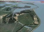
Everybody is asking us about what we plan to do in the next version. Beneath we will reveal some of it. We will not guarantee anything, some of it may not apply without notice. But we do want to inform you about the general direction.
FSX
Of course this version will only be FSX compatible. We have already seen promising results. Below is a demo movie of EHVB, which may be an inactive military base, but looks amazing.
A demo movie of EHBK:
The surface has been created using the latest FSX techniques. This is possible, as FSX gives us the opportunity to use 1 meter per pixel photographs (remember, this was not possible in FS2004 without some tricks we applied).
New terrain photographs
In version 4, we will have new terrain photographs. This set has already been corrected for height and colour. Matching has already been done for us this time. This of course will result in more natural colours than in V3. The resolution will be 1 meter per pixel. This set was created in 2005 and partly in 2007. This means that all infrastructural changes will be visible (large infrastructural projects like the “HSL line” which is the high speed train line from Amsterdam to Brussel, the “Betuwe” freight train route from Rotterdam to Germany, and a lot of new suburbs and property development projects are visible now).
Because of the fact that the Ministry of Defence has relaxed its criteria, we will need no more patching of the restricted areas. While in version 3, we could blend these patches into the environment, it is of course better to use a photo. This means that military bases will be contained in the terrain. We still need the approval of the Ministry of Defence’s Intelligence Service (in Dutch MIVD) just like last time, before releasing it.
More details
We will spend time on details: amongst others, we will scan the whole of Netherlands to see where the water surface is parted by a road, we will repair them as much as possible. Lots of it had already been done in V3, but we will clean this version up even more. We’re already working on that.
Other things which we would like to do but are not hard defined milestones, because we need to assess the technical feasibility (and see the effects on frame rates):
- autogen trees (lines of trees as well as big forests)
- increasingly more generic objects, like chimneys, water towers and church towers
Airports
The terrain of the airports will get a facelift too, FSX compliant as far as it goes. Previously, we included our airports using older methods because of the 1 meter per pixel requirement in V3. The techniques we are going this time round will be FSX compliant as much as possible. We certainly hope to create less problems with other add-ons this time. We also expect frame rate improvements.
Furthermore, we are thinking about providing airports in a modular way, so you can choose a subset or specific files to download and install. This way, you can install them with or without the terrain layer (this was high on our users’ wish list).
We are looking at releasing the larger airports with a 40 cm per pixel resolution. We are hoping to get hold of the required photographs very soon. This unfortunately holds true for only the larger airports like EHAM and EHRD, EHBK, EHGG but not for EHLE and EHHV and the rest, which will remain on 1 meter per pixel.
When will version 4 be released?
We won’t give you a date for the release yet. Through the experience of 3 main and several subreleases we know that it’s hard to keep a promise, simply because we devote our free time to do it. We have our internal goals and deadlines but will adjust these when needed. We don’t expect anything major before the summer holidays, but then you never know.
So, we do advise you as a current NL2000 user to keep enjoying V3 for the moment being. We will keep you up to date from time to time on our web site.